A comprehensive introduction to cruising for inexperienced skippers.
This course equips you with enough knowledge to navigate around familiar waters by day. A basic knowledge of lights is also included to introduce you to night cruising.
We are continually updating our courses to take into account developments in technology and the electronic navigation aids now available on most cruising boats.
In conjunction with the UK Hydrographic Office we have developed a chart plotter specifically for use on training courses, giving you a realistic insight into electronic navigation. Use of this plotter is an integral part of our Day Skipper shorebased course.
We have northern and southern hemisphere versions of our training materials. So, no matter where you are in the world, our course can be tailored to you.
The course is taught over 40 hours with two exam papers. It can be covered as a series of short sessions, as an intensive week-long course, or by distance learning.
Maximum student:instructor ratio is 4:1
Classroom courses are held here in our classroom at Wickford, Essex.
Course topics include:
- the basics of seamanship
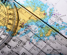
- the essentials of coastal navigation and pilotage
- chartwork
- electronic charts
- position fixing
- plotting a course to steer
- weather forecasting and meteorology
- tides
- collision regulations
- construction, parts and equipment of a cruising boat
- emergency and safety procedures including distress calls,use of flares, safety harnesses, lifejackets and liferafts
A comprehensive introduction to chart work, navigation, meteorology and the basics of seamanship for Competent Crew. You will find this course invaluable if you want to learn to start making decisions onboard.
1. Nautical terms
Parts of a boat and hull
General nautical terminology
2. Ropework
Knowledge of the properties of synthetic ropes in common use
3. Anchorwork
Characteristics of different types of anchor
Considerations to be taken into account when anchoring
4. Safety
Knowledge of the safety equipment to be carried, its stowage and use (see RYA Boat Safety Handbook, C8)
Fire precautions and fire fighting
Use of personal safety equipment, harnesses and lifejacketsd. Ability to send a distress signal by VHF radiotelephonee. Basic knowledge of rescue procedures including helicopter rescue
5. International Regulations for Preventing Collisions at Sea
Steering and sailing rules (5,7,8,9,10 and 12-19)
General rules (all other rules)
6. Definition of position, course and speed
Latitude and longitude
Knowledge of standard navigational terms
True bearings and courses
The knot
7. Navigational charts and publications
Information shown on charts, chart symbols and representation of direction and distance
Navigational publications in common use
Chart correction
8. Navigational drawing instruments
Use of parallel rulers, dividers and proprietary plotting instruments
9. Compass
Application of variation
Awareness of deviation and its causes
Use of hand-bearing compass
10. Chartwork
Dead reckoning and estimated position including an awareness of leeway
Techniques of visual fixing
Satellite-derived positions
Use of waypoints to fix position
Course to steer
11. Tides and tidal streams
Tidal definitions, levels and datum
Tide tables
Use of Admiralty method of determining tidal height at standard port and awareness of corrections for secondary ports
Use of tidal diamonds and tidal stream atlases for chartwork
12. Visual aids to navigation
Lighthouses and beacons, light characteristics
13. Meteorology
Sources of broadcast meteorological information
Knowledge of terms used in shipping forecasts, including the Beaufort scale, and their significance to small craft
Basic knowledge of highs, lows and fronts
14. Passage planning
Preparation of navigational plan for short coastal passagesb. Meteorological considerations in planning short coastal passages
Use of waypoints on passaged. Importance of confirmation of position by an independent source
Keeping a navigational
15. Navigation in restricted visibility
Precautions to be taken in, and limitations imposed by fog
16. Pilotage
Use of transits, leading lines and clearing lines
IALA system of buoyage for Region A
Use of sailing directions
Pilotage plans and harbour entry
17. Marine environment
Responsibility for avoiding pollution and protecting the marine environment